
Since we moved our departure date up by three months many people have asked us where we are starting. Our answer has changed daily. Add to that the confusion that I would give a different answer from Andrew. Mostly that has been happening because we don’t know. We have been busy living our lives and getting ready and aren’t really all that concerned with what direction we ride in when we leave.
But this weekend something shifted. We were asked by some friends what our plans were for the August long weekend. The weekend plans with friends sound like a lot of fun and that was all it took for Andrew and I to really start thinking about where we would go.
I pitched the idea in the last couple of weeks of starting in Alaska. I was reading another cycling blog about someone who started in the Arctic Circle. The pictures were amazing and the idea of starting in Alaska was very appealing to me. I’d love to be able to say I rode my bike from Alaska to Argentina.
Here’s so some ideas are currently flying around the Prenty Palace right now. Check out our options and let us know what you think we should do.

Click the chart to see all columsn. An analysis of the different options including costs, mileage and dates.
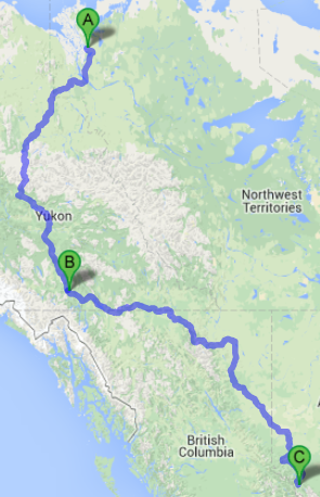
Option 1
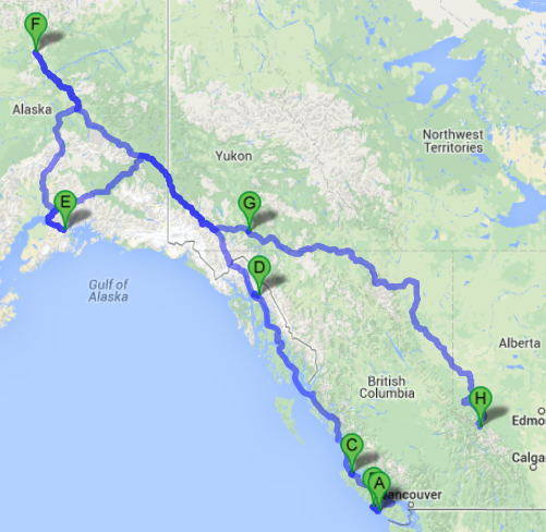
Option 1 map that doesn’t quite show the ferry routes that would happen on the bottom of the map.
Fly to Ucluelet, BC and spend the long weekend in Ucluelet, BC. After the weekend camping trip with friends, ride to Tofino and see that area as we have never been there before. Then take about five days riding to Port Hardy.
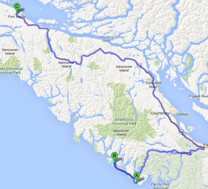
Cycling on Vancouver Island from Ucluelet to Tofino and then to Port Hardy.
Take a one day ferry ride to Prince Rupert. Then take a three day ferry ride to Juneau, Alaska. Then take one last ferry from Juneau to Whittier Alaska.
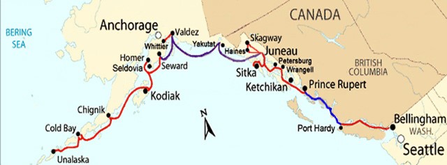
The Alaska ferry routes map.
After arriving in Whittier we would ride north to the Arctic Circle sign which is about 1040 kilometers.

The sign that marks the Arctic Circle in Alaska.
Take our picture and then ride south to visit family in Whitehorse, Yukon which is about 1240 kilometers. Then cycle from Whitehorse to Jasper to see the ice fields which is about 1915 kilometers. Beyond that we would cycle south to the USA border and then meander through the USA to Mexico with an arrival in Mexico in early November.
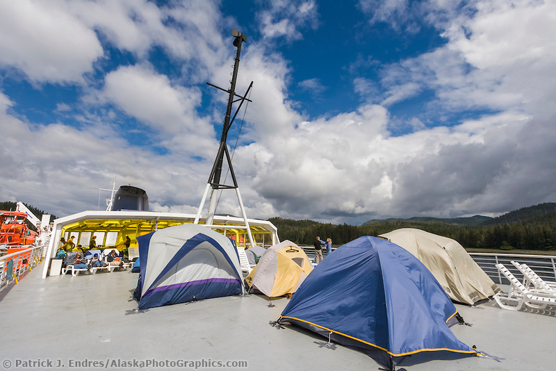
The Alaska ferry accomodations for tenters.
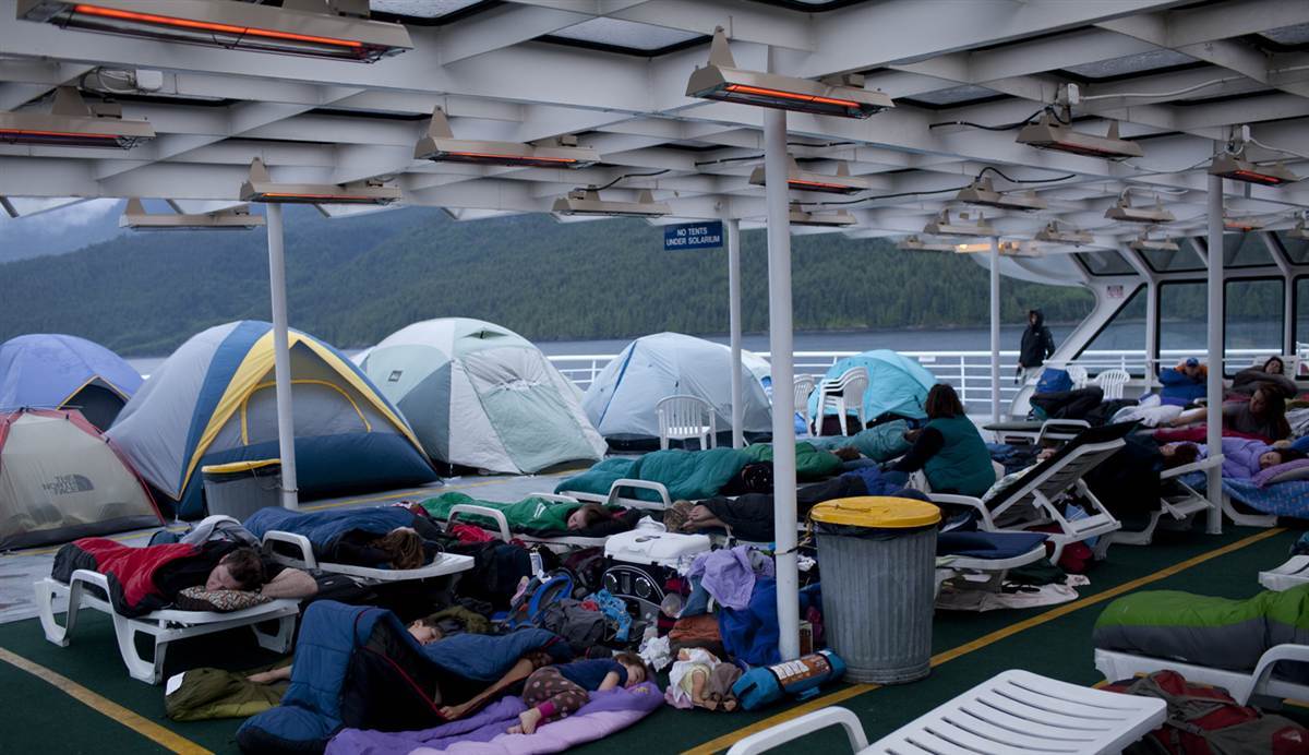
More pictures of others taking the ferry and how you sleep on the ship.
Pros: We’d get to experience some really cool boat rides up the Coast and possibly see icebergs and glaciers. Also some really cool camping on the ship deck.
Cons: We’re likely going to freeze our asses off, it’s quite expensive and time consuming to take the ferry system. We’d also be doing a bit more riding North than other options. By doing it this way we would be in Jasper in October which is dangerously close to winter and snow.
Option 2
This would be the route for option 2 of cycling.
Fly to Ucluelet, BC and spend the long weekend in Ucluelet, BC. After the weekend camping trip with friends return to Vancouver. Then pack up and fly to Inuvik, Yukon. This is essentially the closest you can get to the Arctic Ocean this time of year. The only way you can actually reach the Ocean is to wait for the freezing weather to hit and then the ice roads open up. Once arriving in Inuvik we would ride south to Whitehorse and visit family which is about 1220 kilometers. After that head to Jasper to see the ice fields which is about 1915 kilometers. Beyond that we would cycle south to the USA border and then meander through the USA to Mexico with an arrival in Mexico in early November.
Pros: We’d spend less money because the flights are less expensive than the ferry system. There would also be no backtracking because we are flying to the Northern most point. We’d also be getting to Jasper earlier than option 1 and be less likely to hit snow in the Rockies.
Cons: We would miss out on Tofino and the ferry system.
Option 3
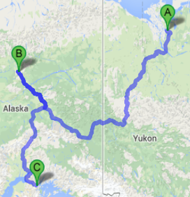
Option 3 map of route.
Fly to Ucluelet, BC and spend the long weekend in Ucluelet, BC. After the weekend camping trip with friends return to Vancouver. Then pack up and fly to Inuvik, Yukon. This is essentially the closest you can get to the Arctic Ocean this time of year. The only way you can actually reach the Ocean is to wait for the freezing weather to hit and then the ice roads open up. Once arriving in Inuvik we would ride south to the Arctic Circle in Alaska which is about 1700 kilometers. Then ride south to Whittier, Alaska which is about 980 kilometers. Then take a ferry from Whittier, Alaska to Bellingham, Washington which is about a four day sailing.
Pros: We would get to see the Arctic Circle and ride the ferry system.
Cons: The most expensive options of them all. We’d also miss out on the ice fields in Jasper and miss seeing family in Whitehorse.
What to do? If I finished work earlier than the end of July this might be possible to do the Alaska ferry routes, but I’ve made a commitment and I should keep to it. That and it would be a terribly expensive start to the trip, but memorable. I’m sure this is the first of many decisions we’ll need to make in the coming years.